
Map of Roman Chester (Deva Victrix)
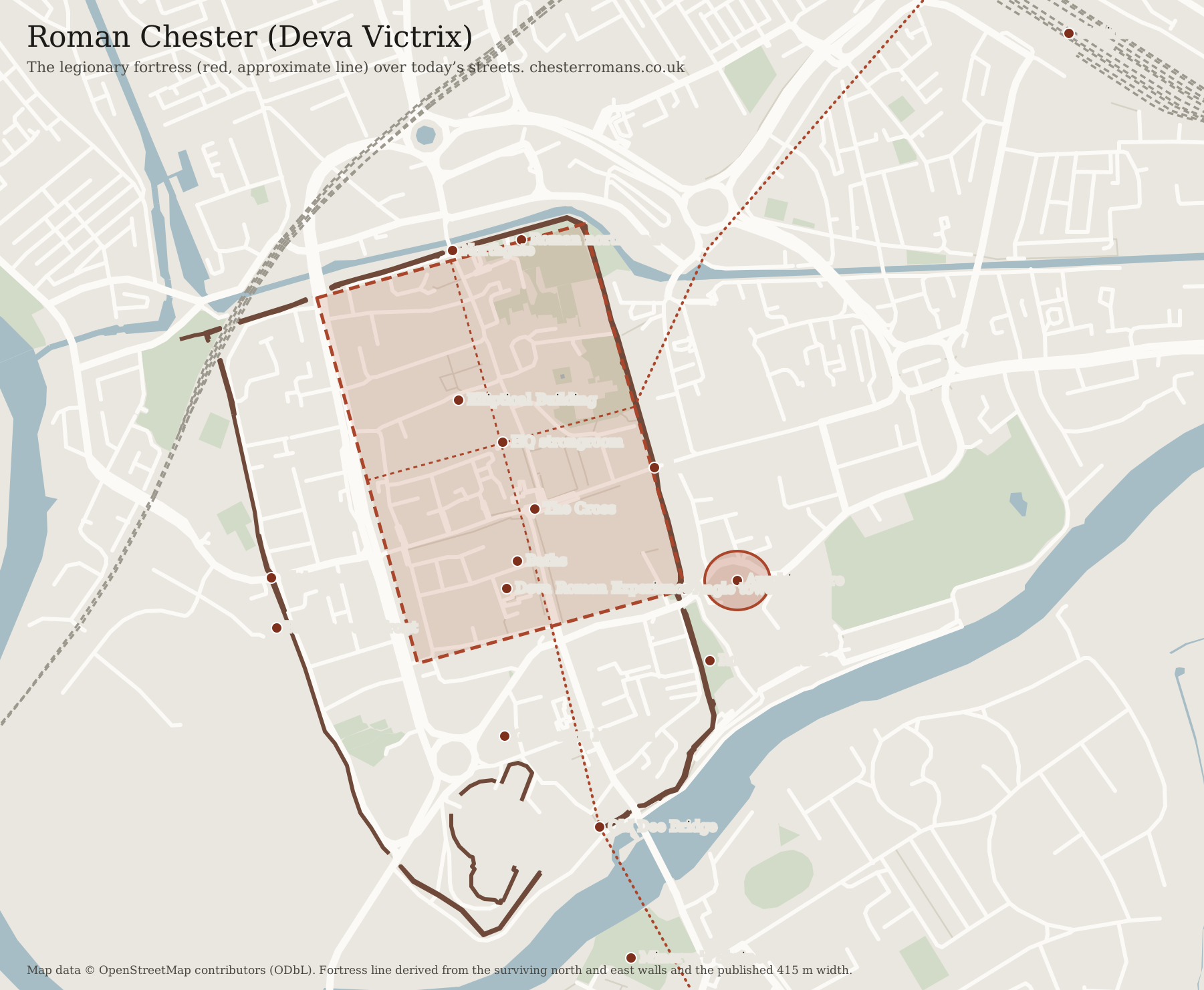
The Roman fortress of Deva lies under the north-east of Chester’s walled centre. Its north and east sides follow today’s walls, its south side ran close to Pepper Street, and the city’s four main streets still meet at the Cross, near the heart of the Roman plan. The map shows the fortress over the modern streets, with everything Roman you can still see.
Roman, still visible · free
Roman amphitheatre
Built just outside the fortress's south-east corner in the late 1st century. About two-fifths of the oval is uncovered; the rest lies under the buildings and Dee House beside it. Free and open daily in daylight.
- Roman, still visible
- Roman finds on show
- Under today's streets
- Rebuilt from Roman stones
- Roman fortress (approximate line)
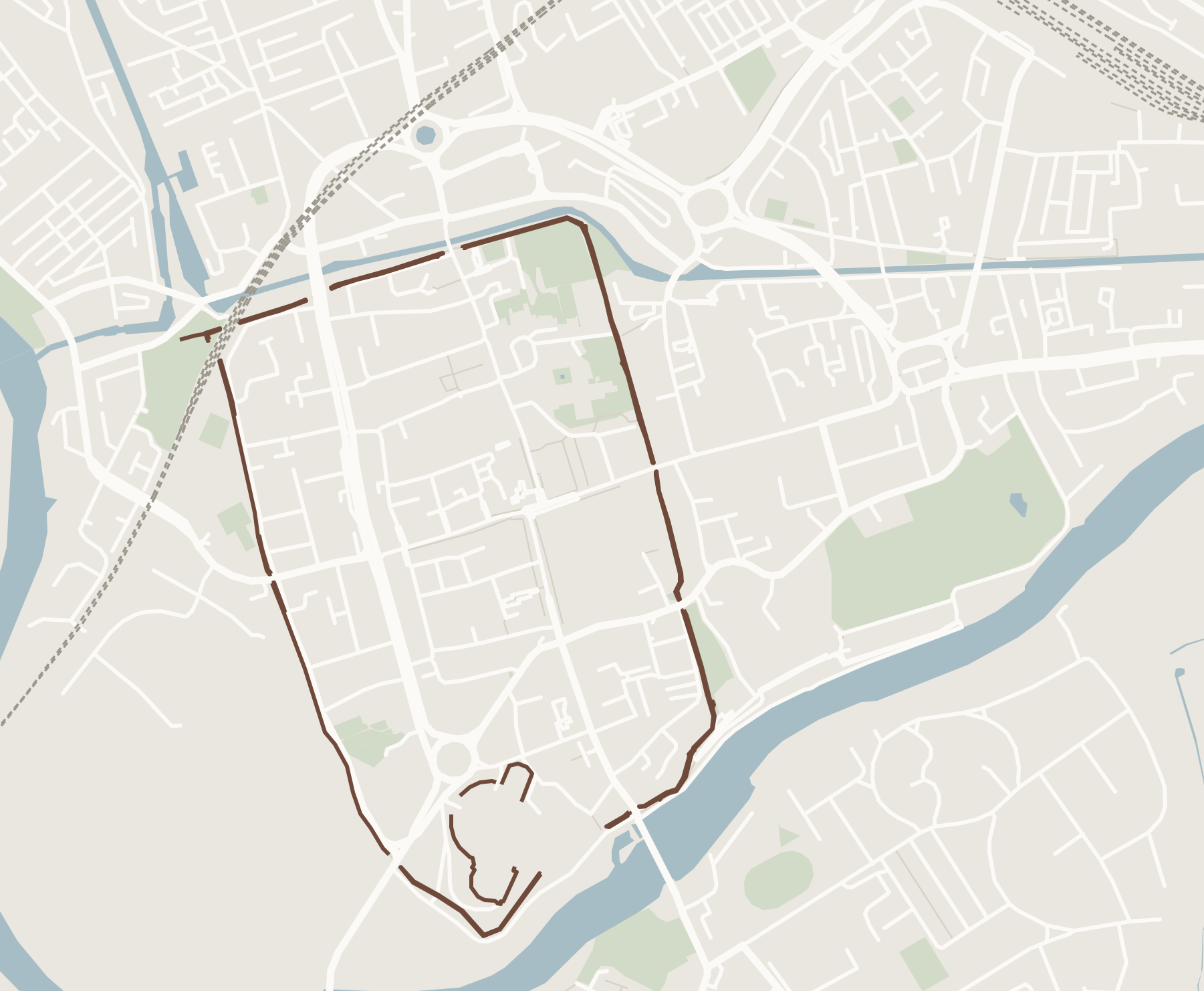
- Today’s city walls
How to read the map
The red outline is the legionary fortress of Deva at its full size, a little under 600 metres long and 415 metres wide, tilted slightly off north like the modern street plan. The dotted lines inside it are its two main streets, running between its four gates. The darker block near the middle stands for the headquarters building, and the oval outside the south-east corner is the amphitheatre, drawn to scale.
The outline is an informed approximation, not a survey. It is fixed to two places where the Roman defences are certain, the north-east corner at King Charles’ Tower and the south-east angle tower beside Newgate, and set to the fortress’s published width. The brown line is today’s circuit of walls, which the Saxons and Normans extended west and south to the river.
What was inside the fortress
A legionary fortress followed a standard plan, and Deva was a large one. Long barrack blocks for the men filled most of the space, with bigger houses for the officers. At the centre stood the principia, the headquarters, with the shrine where the legion kept its standards and pay. Near the south gate was a vast bath-house; elsewhere stood granaries and workshops. Behind today’s Town Hall stood the oval Elliptical Building, which has no known parallel anywhere in the Roman empire.

Roman places you can still see
Roman, still visible
- Roman amphitheatre: The largest known Roman military amphitheatre in Britain.
- South-east angle tower: The footings of a corner tower of the fortress, by Newgate.
- Roman north wall: The most Roman masonry left standing on the walls.
- Headquarters strongroom: Part of the legion's headquarters building, behind the Town Hall.
- Minerva's Shrine: A goddess carved into a Roman quarry face, across the Dee.
- The Roman waterfront: A massive Roman wall by the Roodee, traditionally called the quay.
Rebuilt from Roman stones
- Roman Gardens: Columns, carved stone and a rebuilt hypocaust. Free.
Roman finds on show
- Deva Roman Experience: Hands-on attraction with a reconstructed street and a real dig.
- Grosvenor Museum: Roman tombstones taken from the north wall. Free.
Under today's streets
- The Elliptical Building: An oval building with no known parallel anywhere in the Roman empire.
- The fortress baths: A huge bath-house; a heated floor survives in a Bridge Street cellar.
Using the map on a visit
Everything on the map is within a short walk of the Cross. The amphitheatre, the Roman Gardens and the south-east angle tower are together by Newgate; the Roman north wall is a ten-minute walk north along the walls; Minerva’s Shrine is across the Old Dee Bridge in Edgar’s Field. For a route that links them, follow the free self-guided Roman walk.
Street map built from OpenStreetMap data, © OpenStreetMap contributors, available under the Open Database Licence.
Questions people ask
Where was the Roman fortress in Chester?
Under the north-eastern part of the walled city centre. Its north and east sides followed the line of today's north and east walls, its south side ran roughly along Pepper Street, and its west side lay well inside the later medieval west wall, which the Saxons and Normans pushed out towards the river.
What did Roman Chester look like?
A large rectangular legionary fortress with rounded corners, a stone wall with towers, four gates and an orderly grid of barracks, granaries, baths and a headquarters building. Outside the walls stood the amphitheatre, a civilian town and the waterfront on the Dee.
Which Roman streets survive in Chester?
The pattern survives rather than the paving. Eastgate Street, Watergate Street, Northgate Street and Bridge Street meet at the Cross, close to the centre of the Roman fortress, and broadly follow its main streets out to its gates.
Can I print the map of Roman Chester?
Yes. Use the print button above the map, or download the labelled map as an SVG file, which prints sharply at any size.
Facts and visitor details checked 26 October 2026. Opening times and prices change, so check with the venue before you travel.